Last Updated on September 22, 2025 by freebuffalo
From Khorog it was all up, climbing gradually. The first day I was meant to cycle 55km but the hotel was closed so I had to cycle 35km further to find a homestay at around 2900m altitude. The following day was a 50km ride to Jelondy hot springs. This was not as spectacular as it sounded. The hot water spring was not in an open environment, rather the hotel has made a pool indoor using a hot spring which felt more like a bath. The sulphur smell was omnipresent throughout the hotel.


The third day was a pass at 4280m high (Koitezek pass). On top of this, I was told there were bad roads and I had planned 80km in total for that day. This made a bit anxious but made it to the top of the pass with some difficulties but the challenge came afterwards on the dirt road. It was just stones and potholes – dusty, bumpy and slippery and took forever to navigate . The road descended to a slightly lower altitude before climbing again to 4100m. At the end of this second (mini)pass, there was some asphalt road for the final 25km to Alichur at 3900m. Any sign of black tarmac surface, never mind whether it was rough or smooth, brought a massive relief. Finally after 3 days I was firmly in the high altitude Pamir region. There was a decent guesthouse in Alichor – a desolate and barren area. There were a few houses, all single storied, the walls were made of dirt and rock with tin roofs. It would be harsh to live under these conditions in winter here. Hats off to these people.

The fourth day was a gentle climb once again to 4100 before a descent to Murghab at 3600m. There was asphalt almost the whole way but of varying surface quality. It was an enjoyable ride though, covered100km in 5 hours, felt great. The landscape some people called it ‘moon like’- as in barren mountains and rocks of various colours.
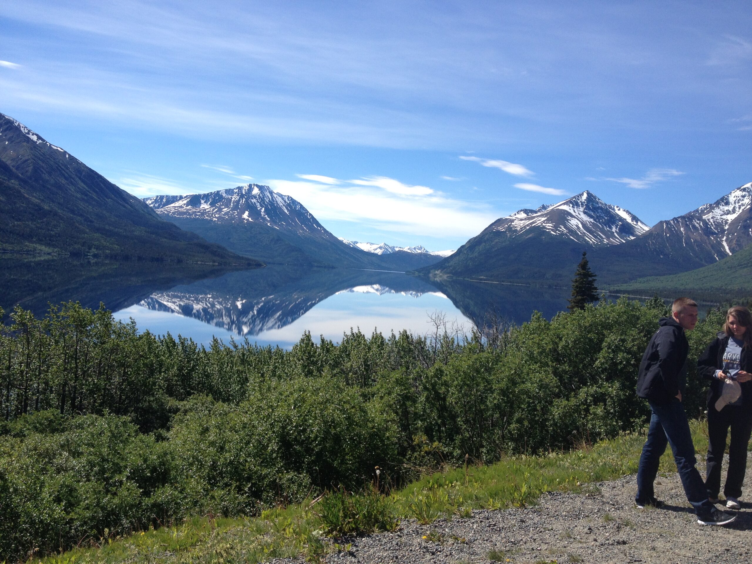
Murghab is the junction where a road east goes to China and another road goes north to Kyrgyzstan. All the trucks turns towards China and the road north was only for foreigners, as in, mainly tourists. Locals are not allowed to use that border. The electricity line also stops at Murghab. It was another 185km to the border. There was a large lake by name Karakol (Qarakol) with the backdrop of some stunning, tall snow capped mountains that makes for dramatic scenery. There were a few houses near this lake and also a couple of guest houses, largely for the tourists. Power supply was through diesel generators but only available in the evening. No internet either. The winds seem to be strong here at all times and the massive lake only makes the winds colder. This place looked something like in a survival-adventure movie.


From Murghab to this lake was about 133km and over a pass at 4655m (Ak-Baital pass), the highest pass in the Pamir Highway. It was a gradual ascent over 73km from Murghab followed by a gradual descent to Karakol at 3900m altitude over another 60km. I was quite anxious as it would be a long day and there were no places in between. There were two yurt camps over this 133km, which were inhabited in the summer time by shepherds where cyclists often took refuge, but their existence was not guaranteed. I had planned to do the whole 133km in one day as I don’t carry stove or cooking stuff. I managed the ascent pretty well, the last four kilometres of this was steep and bad roads again. I had to push my bike here, an altitude at which even walking became a massive struggle. I arrived at the summit around 2pm. I was hoping to see a signpost of the altitude but there was none -no celebratory picture.


There were three more hours of day light which should be good to cover the remaining 65km, I thought, so I carried on. There comes another 20km of really rough road on the descent which slowed the progress. By the time I hit the asphalt road it was 3.30pm and the sun had started to go behind the mountains. There was some sort of storm/strong crosswinds that kept pushing me off the road. I had 35km yet to go and I realised this was not going to happen. I was still at 4000m altitude and it got cold very quickly, especially with the wind chill. I found a shelter in a corner, behindd some large rocks and I decided to pitch my tent there. I got into the sleeping bag as quickly as I could and did not even think of food or water. I guess it’s the Maslow’s hierarchy of needs, survival being at the bottom of the pyramid. I had no appetite and managed to stay warm – the tent fluttering all night due to strong winds. Around 5.30am I had some bread and peanut butter, which I carried for emergency purposes – served me well. Later, around 7am the sun started to come out and winds died down. I packed up and cycled the remaining 35km in 90 minutes.
On arrival in Karakol, a couple who were travelling in the opposite direction gave me a bad news. Due to power supply issues the Kyrgyzstan border is closed most of the day and some cyclists were camping out there. My guesthouse host at Karakol also confirmed this. It’s either wait for the border to reopen or return to Dushanbe which was around 900km away. Luckily a jeep with three backpackers pulled up an hour later. I asked them if they would take me to the border as I thought it is better to be in a car if I had to return. The Kyrgyzstan border was about 65kms away from Karakol. Within 2 hours of arrival in Karakol I packed my bags and left in the jeep. The folding bike came in handy as it could be folded away and put on top of the jeep. We arrived at the border around 3pm. The Tajik border and Kyrgyzstan border are separated by about 20-25km of no man’s land and a pretty rough road. The border guys had no information. Any questions, we were just asked to sit down (not politely). We had no idea even if it would open at all. However, around 7pm, power supply was restored and they had the computers running. Finally we managed to leave around 8pm. I successfully crossed the border and was more than happy to miss the 25km of dirt road. Sary-Tash was the village on the other side of the border from where I cycled to Osh, over a further two days. There was asphalt road the whole way and it was a pleasant ride through several canyons and beautiful scenery, although, I had to go over a pass on each of those two days.
Overall, Pamir Highway, Dushanbe (Tajikistan) to Osh (Kyrgyzstan), was a fantastic experience, an adventure that combined both cycling and high altitude mountaineering. It tested my limits several times. With some perseverance, patient and planning I was to make it and I am grateful to have seen this unique landscape -almost a once in a lifetime experience.
Route (641km): Khorog – Patkhur (81) – Jelondy (50) – Alichur (83) – Murghab (103) – middle of no where (102) – Qarokul (Karakol lake 33) – Sary Tash (by jeep) – Gulcho (106) – Osh (83)

Leave a Reply